Travel notebook
Ti Top Island Beach and viewpoint guide
Ti Top combines a small managed beach with one of Ha Long's familiar high viewpoints, but it is a timed cruise stop rather than an independent beach day.
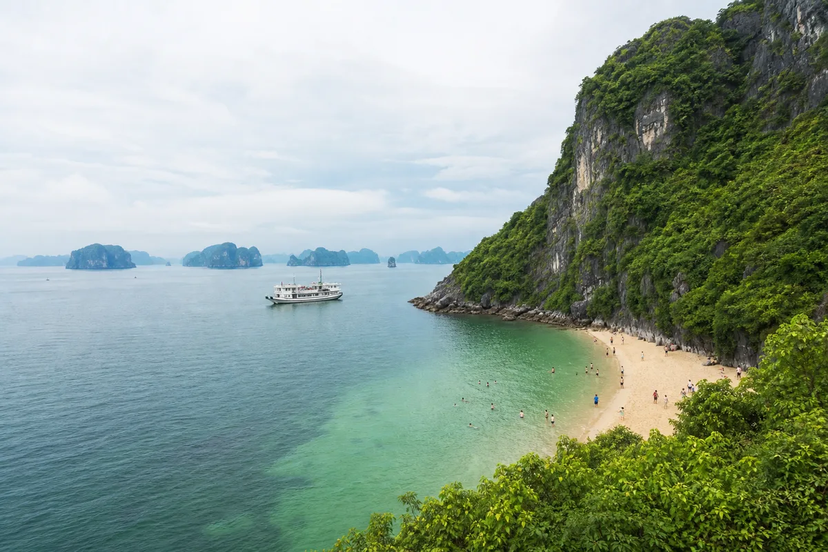
Ti Top is not a beach that you visit independently. It is a managed island landing on Ha Long sightseeing Route 2, normally reached as one part of a day or overnight cruise programme. The stop pairs a compact crescent beach with a steep stair climb to a broad view across the limestone islands.
That combination makes it memorable, but it also creates a decision: use limited shore time for the water, the viewpoint or a careful mixture of both. A sales page showing all three does not prove that your departure gives enough time to do everything.
Locate the island before judging an itinerary
The Ha Long Bay management authority places Ti Top in Cat Nang channel, approximately 12 kilometres southeast of Tuan Chau International Marina and 11 kilometres from Ha Long International Passenger Port. It belongs to Route 2, whose wider official attraction list includes names such as Sung Sot Cave and Luon Cave.
Those distances do not translate into a fixed sailing time. Vessel speed, route order, harbour control and other calls determine when you arrive.
There is no road, taxi approach or ordinary independent passenger ferry to the island. The practical access method is a licensed cruise or sightseeing vessel whose approved programme includes the landing.
Route 2 does not mean every Route 2 attraction
The authority’s full route description lists permitted sites. An individual operator may use only part of that sequence, and weather or operational instructions can change the day. Before paying, ask for:
- the exact route and named stops on your departure;
- whether Ti Top is a landing or only a sail-past;
- the actual passenger port and vessel name;
- approximate time allocated ashore;
- whether swimming is planned and optional;
- what replaces the landing if it is suspended;
- whether a tender or steps are used to reach shore.
Keep the answer in writing. “Route 2 cruise” alone is not enough to establish the day’s sequence.
Understand the physical scale
The management authority lists a beach area of roughly 500 square metres and a 170-metre walking path toward the top. Its June 2026 update describes a climb of more than 400 stone steps to the viewpoint.
The numbers explain the experience better than a wide-angle photograph. The beach can fill quickly when several boats call. The stairway can become a slow two-way queue, especially in heat. There is little value in sprinting to the top and returning late to the vessel.
| Your priority | A sensible use of the stop | Main risk |
|---|---|---|
| View across the bay | Start the climb promptly, pause when needed and turn around with a large time margin | Heat, slippery steps, queueing and underestimating the descent |
| Swimming | Confirm the marked area is open, change efficiently and remain near shore | Assuming online photos guarantee swimming that day |
| Travelling with young children | Choose one activity and keep the group together | Crowds, steep stairs and losing track of the vessel deadline |
| Limited mobility | Ask the operator about landing steps and whether staying aboard is comfortable | Treating “island visit” as step-free or accessible |
| Photography | Use lower viewpoints or the shore if the full climb is unsuitable | Blocking stairs or moving outside barriers for an angle |
The viewpoint climb
The upper viewpoint is the reason many travellers select Ti Top. Expect a sustained outdoor stair climb rather than a gentle scenic walk. Surfaces can be wet, the route has limited passing space, and shade or resting room should not be assumed at every point.
Wear shoes with grip, carry only what you need and keep both hands available on difficult sections. If you have knee pain, balance limitations, heat sensitivity or a heart or respiratory condition, discuss the effort with a clinician where appropriate and with the operator before departure.
You do not need the summit to have a worthwhile stop. A lower point or the beach can still provide island-and-bay views without turning the call into a race.
Swimming at Ti Top
Swimming is possible only when the managed bathing area is operating and conditions permit. Quang Ninh’s tourism authority reports that designated beaches use warning flags, boundary buoys, observation posts and rescue teams. The World Heritage management board also inspected lifesaving arrangements at Ti Top during the 2026 peak season.
Use those protections properly:
- Enter only after crew or site staff confirm swimming is allowed.
- Stay inside the marked area, even when the water outside looks calm.
- Follow flags, whistles, loudspeaker messages and barriers immediately.
- Do not dive from rocks, pontoons or a tender.
- Keep children within arm’s reach and nominate one supervising adult.
- Return to the meeting point well before the stated final time.
Tide can alter the amount of exposed sand, while wind, rain or harbour instructions can cancel swimming. An operator changing the stop for safety is not evidence that the island has permanently closed.
Beach or summit: make the choice before landing
If the operator allocates a short call, decide on the boat rather than halfway up the stairs. Ask crew for the current walking estimate and final boarding time. Set an offline alarm with a conservative return margin.
Trying to complete the full climb, swim, change and buy refreshments can leave no allowance for queues. Couples or families may reasonably split priorities, but agree on one meeting point and make sure each person knows the vessel name.
Crowds and a more realistic expectation
The management board describes Ti Top as one of the bay’s most popular destinations. Expect other groups during peak periods. Early or later calls may feel different, but no operator can guarantee an empty island.
The site has service facilities, but it is not an overnight beach settlement. Bring the water, sun protection and medication you need for the excursion, subject to protected-site and single-use-plastic rules. Take every item back to the boat unless staff direct you to an appropriate bin.
Naming and historical context
The island was historically marked as Cat Nang. In 1962, President Ho Chi Minh visited with Soviet cosmonaut Gherman Titov and proposed the Ti Top name in commemoration. English spellings vary between Ti Top, Titop and Titov; they refer to the same managed island stop.
Use “Ti Top” when matching the current management authority’s English route information, but recognise the variants on maps and operator programmes.
Weather and cancellation planning
Vietnam Tourism describes June to August around Ha Long as hot, humid and prone to storms. April and May are generally sunnier, while winter can be cool and misty. Conditions on the water still matter more than the month.
Do not book a flight, train or separate non-refundable activity immediately after the advertised cruise return. A changed route can affect timing even when the port remains open. Read the operator’s weather cancellation and refund terms before paying.
If Ti Top is essential to you, ask what happens when the landing is closed: route substitution, time elsewhere, credit or no compensation. The answer belongs in the booking terms, not an assumption.
Compare it with other beach choices
Choose Bai Chay Beach for a flexible city swim without another boat. Choose Quan Lan or Minh Chau for a multi-night island beach trip. Choose Ti Top when the priority is a classic cruise landing paired with a viewpoint and you accept that the stop is small, timed and conditional.
The complete Ha Long beach guide sets all of those options beside Tuan Chau and Cat Ba.
Sources and live verification
- The Ha Long Bay management authority’s Ti Top record establishes the official route, distances, beach area, walking path and historical naming.
- Its June 2026 Ti Top feature describes the crescent beach and climb of more than 400 stone steps.
- The authority’s Route 2 catalogue gives the wider permitted attraction pattern.
- Quang Ninh Tourism’s beach-safety report explains managed bathing zones and rescue arrangements.
- The World Heritage management board’s June 2026 inspection report covers current Ti Top safety and visitor-pressure work.
Verify with the operator before departure: passenger port, vessel, Route 2 sequence, Ti Top landing, swimming status, time ashore, mobility requirements and the weather-change policy.
Put it on the map
Addresses and map points
Use these points for orientation, then match the exact terminal, entrance or meeting place to your current confirmation.
Ti Top Island
Ha Long Bay, Quang NinhVietnamA managed island stop on Ha Long sightseeing Route 2; there is no road or independent public ferry.
Tuan Chau International Passenger Port
Tuan Chau, Quang NinhVietnamOne possible departure port; use the terminal printed on the operator's latest voucher.
Ha Long International Cruise Port
Bai Chay, Quang NinhVietnamA separate possible departure port in Bai Chay; never substitute one terminal for the other.
Keep exploring