Beach planner
The practical guide to Ha Long Bay beaches
Ha Long's beaches serve very different trips: some are reached from the city pavement, some only on a cruise, and others require a ferry and an island stay.
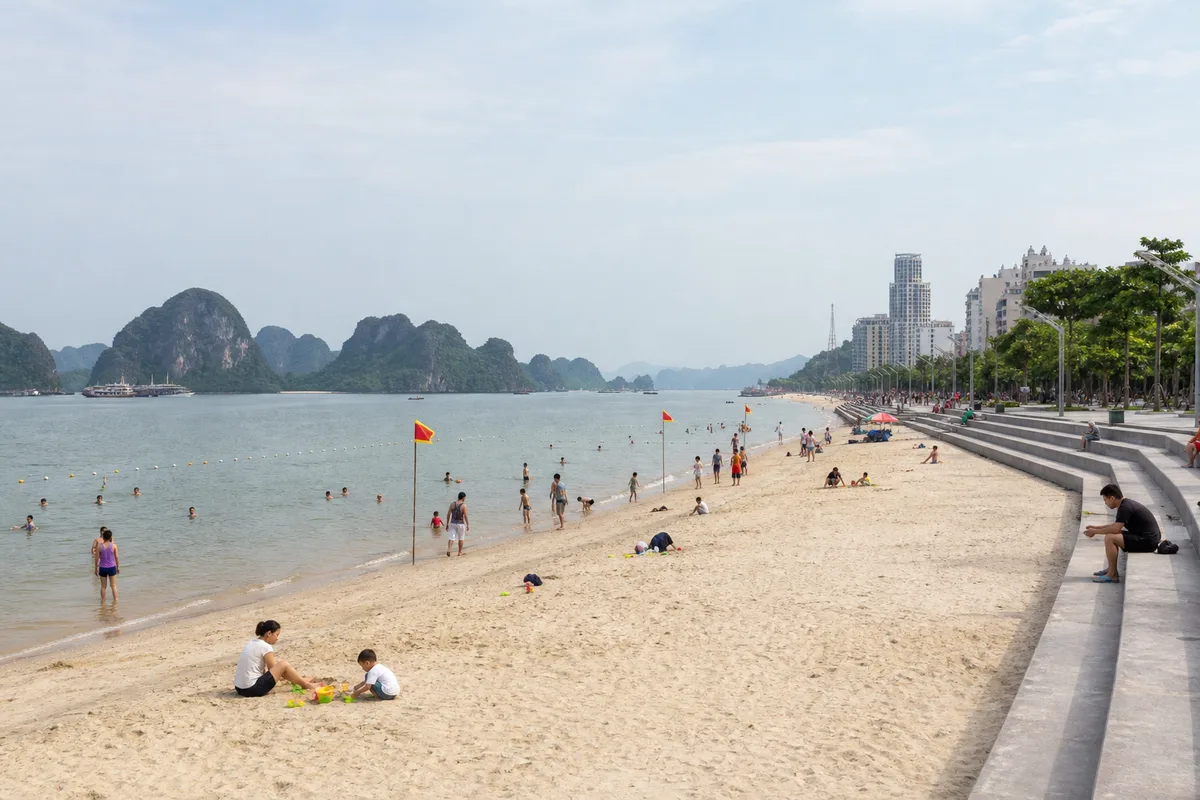
Compare the settings
City shore, cruise landing or island stay
The beach name alone does not reveal the journey. These three settings require road access, a licensed cruise or a separate passenger-boat connection.

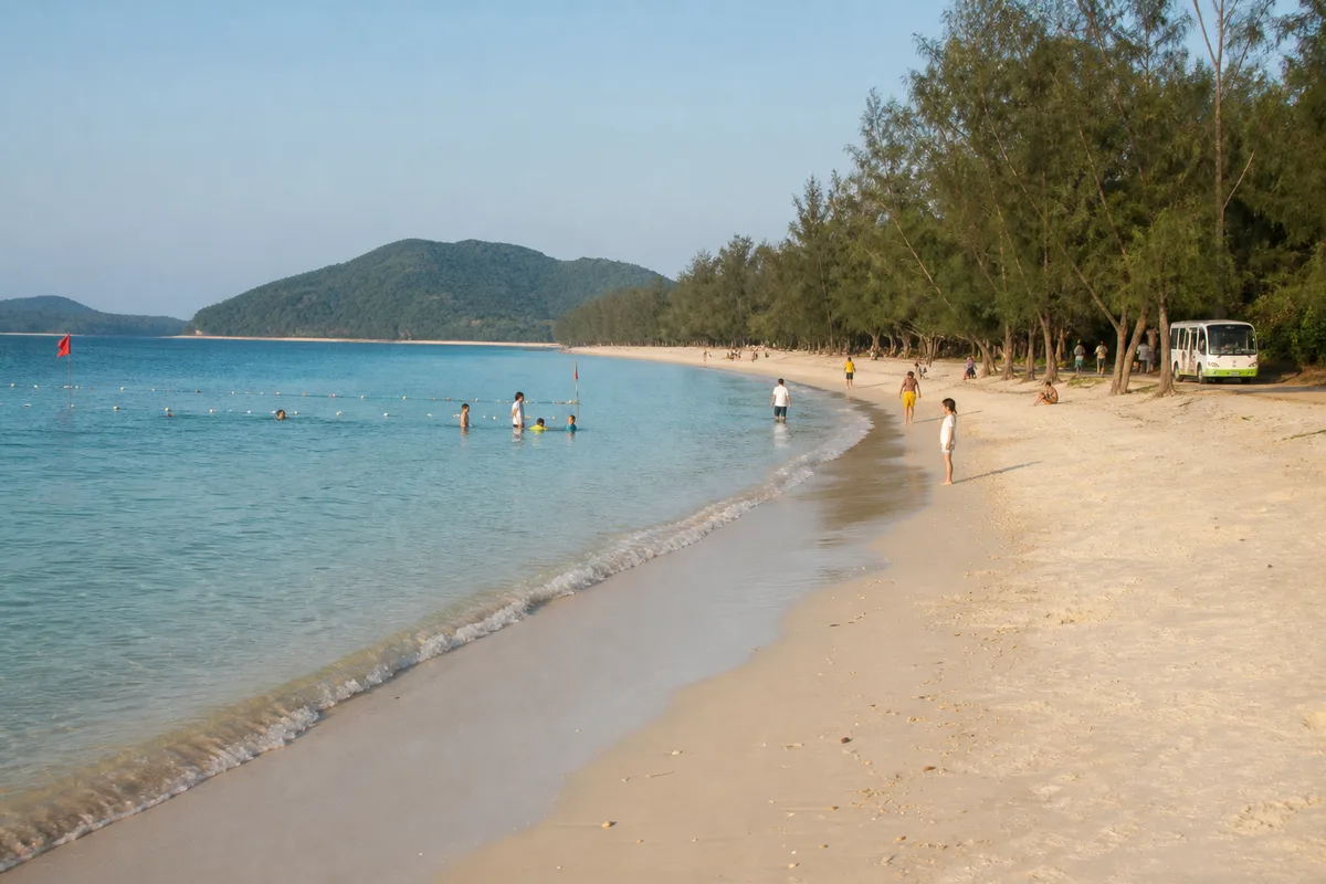

There is no single answer to “the best beach in Ha Long”. The useful answer depends on whether you want a flexible swim from a city hotel, a short beach landing during a cruise, or a separate island holiday. Those options use different ports, tickets and amounts of time.
The most common planning mistake is treating every beach name as if it were a taxi ride from central Ha Long. Bai Chay and Tuan Chau are road-accessed; Ti Top is a managed cruise stop; Cat Co belongs to a Cat Ba stay; Quan Lan and Minh Chau require a passenger-boat journey toward Bai Tu Long.
Choose by access first
| Beach area | How you actually reach it | Best for | Important limitation |
|---|---|---|---|
| Bai Chay | Walk, taxi or local road transfer within the Bai Chay visitor area | A flexible swim or waterfront break before or after a cruise | An urban, developed beach rather than a quiet natural cove |
| Tuan Chau | Road transfer onto Tuan Chau island | Adding beach time when already staying near the island | The swimming beach and passenger marina are different places |
| Ti Top | A licensed sightseeing boat on an itinerary that includes the island | A short swim paired with a high bay viewpoint | Small beach, steep climb, crowds and a fixed vessel schedule |
| Cat Co beaches | First reach Cat Ba island, then walk or use local transport from Cat Ba town | Combining beaches with a Cat Ba or Lan Ha stay | Separate transport system and local authority from Ha Long City |
| Quan Lan and Minh Chau | Passenger boat from the Van Don side, then an island transfer | A slower multi-night beach trip | Not an add-on to an ordinary Ha Long sightseeing cruise |
Our detailed guides cover Bai Chay Beach, Ti Top Island and Quan Lan–Minh Chau. Use the Cat Ba guide if the Cat Co beaches are part of a second island base.
Bai Chay: the convenient city beach
Bai Chay is the practical answer when you want beach time without committing to another boat. Quang Ninh’s tourism material describes a broad sandy shore backed by developed visitor infrastructure, and current provincial coverage shows it operating as an active bathing beach.
Official material uses several overlapping labels, including Bai Chay Beach, Ocean Park Beach and Ha Long Beach in the Bai Chay tourist area. A map app or taxi driver may therefore use a different label from your hotel. Match the pin to the Bai Chay waterfront rather than assuming that any result containing “Ha Long beach” is correct.
Choose it for convenience, evening activity and nearby food—not for isolation. Heavy-rain runoff, wind, tides and visitor numbers can all change how the water and shore feel on a particular day. Read the full Bai Chay Beach guide before building it into a port transfer.
Tuan Chau: beach and marina are not the same stop
Tuan Chau is connected to the mainland by road and contains both a managed beach area and one of the bay’s main passenger ports. Quang Ninh’s 2025 water-safety reporting included Tuan Chau among Ha Long’s recognised tourism beaches, and provincial reporting showed swimmers there in May 2026.
That does not make the beach part of a cruise ticket. A transfer booked for Tuan Chau International Passenger Port may deliver you directly to the terminal, not to the sand. Save separate map pins and ask your accommodation about current beach access, changing facilities and any fee. We found no dependable current official page establishing permanent opening hours or free entry, so this guide does not invent either.
Tuan Chau works best when you deliberately leave a generous gap around cruise check-in. Do not plan a swim with luggage in a taxi while counting on an exact boat return time.
Ti Top: a cruise landing, not a beach base
Ti Top’s crescent shore sits among the limestone islands and is paired with a steep viewpoint. The Ha Long Bay management authority places it on sightseeing Route 2, about 12 kilometres southeast of Tuan Chau International Marina and 11 kilometres from Ha Long International Passenger Port.
The beach itself is small. The authority lists roughly 500 square metres of beach area, while its June 2026 destination update describes more than 400 stone steps to the viewpoint. On a busy call, swimming, climbing and queueing all compete for the same time ashore.
You cannot reach Ti Top independently by road. Buy a cruise whose written itinerary names the landing, then confirm whether swimming is planned and what happens if weather or harbour instructions change it. Our Ti Top Island Beach guide explains the trade-offs.
Cat Co: town beaches on the Cat Ba side
Cat Co 1, 2 and 3 sit close to Cat Ba town. They make sense when Cat Ba is already one of your bases, not when you have a spare hour in Bai Chay. Vietnam’s national tourism site identifies the three sandy beaches near town, while Cat Hai’s local authority has used seasonal traffic controls around the access roads during peak demand.
Cat Ba shares the wider World Heritage property with Ha Long Bay, but it has different ferries, local transport and operating notices. Resort development and traffic arrangements can also affect the route to individual beaches. Start with our Cat Ba transport and activity guide, then confirm the currently open pedestrian approach locally.
Ba Trai Dao: a route-dependent Lan Ha stop
Ba Trai Dao is another Cat Ba-side name that appears in older Ha Long beach guides. Cat Hai’s official tourism material places the area in northern Lan Ha Bay and describes numerous small natural sand patches, while Hai Phong’s authorised bay routes include Ba Trai Dao on a longer itinerary from Ben Beo.
Treat it as a boat-route area, not an independently accessible public beach. Tide, conservation controls and the operator’s permitted programme determine whether a landing or swim is possible. A route name on an old page is not an opening notice. Ask a licensed Cat Ba operator for the exact route and current activity, and do not attempt an unapproved landing.
Quan Lan and Minh Chau: make them a separate island trip
Quan Lan and Minh Chau offer a longer beach stay in the Bai Tu Long area. In 2026, Quang Ninh confirmed passenger services from Ao Tien Passenger Terminal to both island areas, plus local electric-vehicle transport and growing accommodation demand.
This is not the place to improvise a same-day connection around an international flight or train. Boat operations are weather-dependent, island transfers take time, and rooms can fill during summer weekends. Two nights allow a far more useful margin than racing out and back for one afternoon.
The local authority created beach-management and rescue arrangements for both Quan Lan and Minh Chau for summer 2026. Those rules are a reminder that supervised bathing has operating periods: do not turn one year’s hours into an evergreen promise. Follow the current signs, flags and staffed zones on the day. See the full island beach guide.
Ngoc Vung: another overnight island, not a spare-hour beach
Ngoc Vung is a separate Van Don island destination with Trường Chinh Beach on its southern side. Van Don’s March 2026 visitor guide identifies passenger access from Ao Tien and local travel by electric vehicle or motorbike after arrival. It gives a broad 60–120 minute crossing range depending on vessel type, which is useful only as orientation—not a timetable.
Like Quan Lan and Minh Chau, Ngoc Vung needs a confirmed boat, island transfer, accommodation plan and weather buffer. Its quieter reputation does not make unstaffed swimming safe. For a first regional island extension, the more detailed Quan Lan–Minh Chau guide provides the planning framework to apply.
Soi Sim: check status instead of repeating an old itinerary
Soi Sim appears in route descriptions and older beach lists, but access is not a fact to assume. In June 2026, the Ha Long Bay–Yen Tu World Heritage Management Board said it was assessing infrastructure and preparing for the beach’s future tourism operation.
Until the responsible authority publishes a clear opening notice, treat Soi Sim as status to verify, not a guaranteed swimming stop. Do not select a cruise because an undated reseller page promises it.
When swimming is realistic
Vietnam Tourism describes April and May as generally sunny around Ha Long, September to November as cooler with mixed sun, and June to August as hot, humid and storm-prone. That is climate guidance, not a swimming guarantee. A calm morning can change quickly, and authorities can suspend boating and bathing when conditions deteriorate.
Use this hierarchy:
- A current local closure or port instruction overrides every itinerary and online guide.
- On-site flags, barriers and lifeguard directions override your plan to swim.
- Stay within the marked bathing area and staffed period.
- Do not enter water at an unmanaged cove simply because another visitor is there.
- After heavy rain, poor visibility or a weather warning, choose a shore walk instead.
Quang Ninh’s tourism authority reports that managed beaches use boundary buoys, warning flags, observation posts and rescue personnel. These protections work only when visitors remain in the designated zone.
Build a beach day that survives changes
If you are sleeping in Bai Chay
Use Bai Chay as the flexible option. Go after checking the day’s flags, keep valuables out of unattended bags and combine the waterfront with a meal rather than another fixed ticket. Leave enough time to return, shower and collect luggage before a departure.
If the beach is part of a cruise
Choose the route for its overall sequence, not one photograph. Ask whether the Ti Top landing is confirmed, whether swimming is optional and whether towels or changing space are provided. Accept that safety instructions may replace the stop.
If you want a real island break
Choose either Cat Ba or Quan Lan–Minh Chau and give it nights of its own. Map every handoff: mainland terminal, passenger boat, island arrival point, final accommodation transfer and return buffer. A beach is not restful when the itinerary depends on four unverified connections.
Sources and live checks
- Quang Ninh’s 2025 beach-safety report identifies managed tourism beaches and explains marked zones, flags and rescue arrangements.
- The Ha Long Bay management authority’s Ti Top record establishes its route, location, small beach area and viewpoint path.
- The management authority’s June 2026 Ti Top update describes the current stair climb and popularity.
- The management board’s June 2026 site inspection explains why Soi Sim should not be promised without a fresh opening check.
- Quang Ninh’s April 2026 island transport report confirms Ao Tien services toward Quan Lan and Minh Chau.
- Cat Hai’s official tourism information and Hai Phong’s authorised bay-route decision establish Ba Trai Dao as a route-dependent Lan Ha area.
- Van Don’s March 2026 Ngoc Vung guide gives the current Ao Tien access pattern and island transport context.
- Vietnam Tourism’s Ha Long weather guide provides the broad seasonal pattern.
Verify on the day: beach operating status, staffed swimming period, warning flags, local road controls, boat departure point and weather. Never use an old blog’s timetable or opening hours as a safety decision.
Put it on the map
Addresses and map points
Use these points for orientation, then match the exact terminal, entrance or meeting place to your current confirmation.
Bai Chay Beach
Bai Chay, Quang NinhVietnamThe urban option: confirm the marked bathing zone and current swimming instructions when you arrive.
Tuan Chau Beach
Tuan Chau, Quang NinhVietnamThe beach and Tuan Chau passenger port are separate map pins even though both are on the same road-linked island.
Ti Top Island
Ha Long Bay, Quang NinhVietnamThere is no road or independent ferry: book a permitted bay itinerary that specifically includes the landing.
Minh Chau Beach
Van Don, Quang NinhVietnamA Bai Tu Long island beach reached via passenger boat and local transfer, not a routine Ha Long cruise stop.
Keep exploring